11May
We have travelled 4,000 nm or 4,603.12 miles since leaving Valdivia, Chile.
We have 118 nautical miles until Gambier entrance. 34:56 hours. Our current position is 23° 37.023S by 132° 49.446W. Sunset was pretty with lots of pinks among the clouds, our first in French Polynesia 🇵🇫. Half moon lite up the sky before bed.
This has been an adjective full trip, each part is more amazing than before but each has its special place in our hearts. We have made some lasting connections along the way. We look forward to seeing Nanaku and Zingaro ( nicknamed Shadow Cat by us).
 |
| French Polynesia |
 |
| Illès Gambier |
It took us 3 days sailing to the entrance of the Gambiers from Pitcairn. We are entering at 23°15.678S by 134°55.854W, going over the reef with the swell. 7:08 crossing the reef. Everyone feeling excited to be coming in to anchor for a few days with no swell.
 |
| Approaching Gambiers |
 |
| 7:19 am and we are about to enter the passage to Gambier in 5 hours |
 |
| The Gambier Islands, isolated more than 1600 km southeast of Tahiti, include the most eastern islands of French Polynesia . The archipelago, composed of ten high islands and eighteen motu , comes from a single volcano partially collapsed under the ocean. The whole is surrounded by a coral reef 80 km in circumference. Inside the lagoon each high island is itself surrounded by a reef. The island of Mangareva , with Rikitea its main village, is home to almost all inhabitants of the archipelago. The other three big Gambier islands are Aukena, Akamaru and Taravai. |
 |
| Rainbow over the passage |
 |
| Emma is ready as we are for land |
 |
| Keith looking at our next destination |
 |
| Flags of French Polynesia, Quarantine and France |
 |
| Emma: "I smell land and I see it" |
 |
| Keith and Emma excited about seeing land and going to shore |
 |
| Rikitea, Mangareva Island |
 |
| View from the anchorage |
Keith and I did some exploring while on the island, between getting baguettes, brioche, and going to the Post Office to exchange USD. Most times we were at JoJo's getting internet and some items for the boat. We walked up to the church of St. Michael's.
 |
| St. Micheal's Cathedral is made of limestone, built 1839. The alter is mother of pearl and pearls |
 |
| Gothic Revival architecture |
 |
| Anchorage |
 |
| Keith and Martin sitting by the dock at JoJo's |
 |
| The beach by JoJo's looking toward Rikitea |
 |
| The anchorage from the boat looking toward Rikitea |
We spent 12 days in this lovely location off of Rikitea, Mangareva. Keith and I toured the island some. We joined Olga from sv Blue Peter to hike Mont Mokoto, 423 meter altitude, Mont Duff is 441m. We had so much full foraging for pomelo, papaya and raspberries along the trail. We even found red, yellow and green chilies. We met Olga in the forest with raspberry bushes covering the ground. So peaceful and tranquil walking in the shade of the canopy seeing so many white flowers but not many raspberries. Olga has planned to make some kind of dessert to take to a party on another boat.
We collected about 12 raspberries, we all laughed about not getting many. On the decent we came along a dirt road and found papaya, more pomelo and lush rich plants.
We had a memorable encounter while taking photos when a young man from the Australs named Toma asked us to come across the street and see his property and view. We met his girlfriend, Grace. Her grandfather owned the property and they lived and cared for the property. He gave us banana, cucumber and pomelo. We were so grateful for this then he went to the garden across the road and gave us fresh taro.
 |
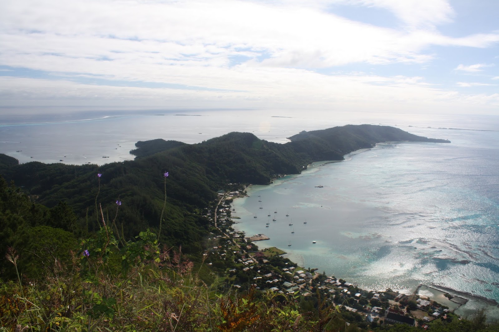
| View from hike on Mont Mokoto |
 |
| Pearl farms located on the island |
 |
| Mont Mokoto view of Rikitea anchorarge |
 |
| Walking down from Mont Mokoto in this peaceful forest |
 |
| Mont Duff from the road after we left the forest with raspberries |
 |
| Flowering Ginger |
 |
| View from Toma and Grace's home |
 |
| Keith, Toma and Wayne |
 |
| Keith, Olga and Wayne |
 |
| Sunset and moonrise |
 |
| We watched the full moon rise over Aukena |
We explored Aukena one day when we went over to see the island. Keith and I took the dinghy to the beach on Aukena. We were greeted by a family on the beach then the son of the caretaker of the island. The son and his nephew showed us the island. We walked down a garden like path to the church, which had wasps flying around it. This is the first church constructed out of stone in all of French Polynesia is also on this tiny island in the Gambier archipelago. Built in 1839, Saint-Raphaël Church is a 19th-century archeological vestige with other ruins along the path.
The boys keep getting fruit for us to try as they took us to the point, we ate coconut that had sprouted and fresh coconut from the tree and drank coconut water. We ate breadfruit, bitter orange, they showed us medicinal plants. There are many wild pigs on the island that they feed coconut. We had the most enjoyable time on shore with the family that lives there exploring the island and foraging for fruit.
 |
| Aukena in the distance from the anchorage in Rikitea, |
 |
| Aukena has reminders of the missionary period, including the hexagonal lookout tower, still used as a landmark, the former seminary and the lime kiln. The white-sand beach leading to the tower. St. Raphael's Church still stands as a reminder of the missionary period. |
 |
| Church of St.Raphael, interior |
 |
| Maintained path to the church and grounds |
 |
| View of Mangareva from Aukena across the lagoon of coral and beautiful water |
 |
| Beach behind the point where the Watchtower sits |
 |
| Pristine beach with coconut palms and warm breeze |
 |
| Shaded beach area, peaceful and quiet |
 |
| The pigs of the island maintained by the family that live here |
 |
| Getting into the dinghy after walking along the beach, we see a storm coming in the distance |
While we were anchored here our friends from Rapa Nui came into the anchorage. We joined Nananku for a hike up Mont Duff (441m). It was a really nice hike past the pomelo tree, where we picked some fruit for the hike. Leisurely hike with some hard points. Keith and I foraged for raspberries as we went along. We met the others at the summit.
 |
| Mont Mokoto seen from Mont Duff summit |
 |
| Rikitea below from Mont Duff |
 |
| Mont Mokoto with Taravai in the distance |
 |
| Francisco, Wayne, Marta and José |
Keith and I went to shore on 22May with the intent to explore the church where the last king of Mangareva is buried then the old convent and forgave for fruit and squash. Initially walking from Rikitea we were drawn to the old coral buildings, ruins from the past of former jail and other buildings but the small lagoon was our main focus.
 |
| Abandoned ruins of the prison |
 |
| Small lagoon near the old watchtower and prison ruins |
 |
| St Pierre Chapel - Tomb of Maputeoa |
 |
Te Maputeoa (baptized Gregorio Stanislas; reigned as Gregorio I; born c. 1814 – 20 June 1857) was a monarch of the Polynesian island of Mangareva and the other Gambier Islands
|
We walked towards the Convent of Rouru , located at the foot of Mount Duff in Mangareva, the first building that we see, to the left of the entrance arch of the convent houses the chapel Saint-Agathe and the infirmary.
This double building, 24 m long, was built in 1848 in large coral stones, under the direction of Father Cyprien Liausu, of the Congregation of the Sacred Hearts of Picpus.
On the North side, there is a large room which served as infirmary for the sisters of the convent and for the inhabitants of Mangareva.Former President Gaston Flosse , was born in this infirmary.
The vaulted chapel , located in the southern part of the building, was used for Masses open to the population.
 |
| Ruins Chapel St Agathe of the Rouru convent and infirmary |
 |
| Interior of Chapel St. Agathe of the Rouru |
 |
| Arch of the Rouru Convent Portal |
 |
| Convent de Rouru: boarding school |
 |
| Pomelo growing on the tree on the convent grounds |
 |
| old ruins below Mont Duff made from coral |
 |
| View into the lagoon from the road below Mont Duff |
 |
| Keith foraging for bananas |
 |
| Wayne finishing husking a fallen coconut |
 |
| Rectory house in Rikitea |
 |
6,193 km Distance from Chile to Mangareva
|
On the 13th day in Mangareva we pull anchor at 12:15pm and set our sites for the Hao in the Tuamotus, 443 miles, 89:27 hours, current position with Gambiers in sight: 23°01.523S by 135°08.369W.