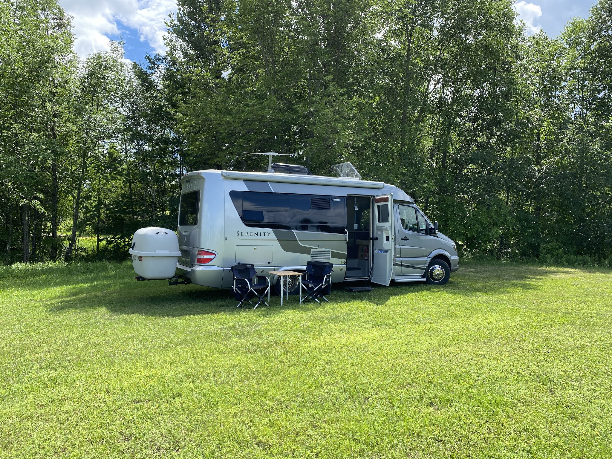
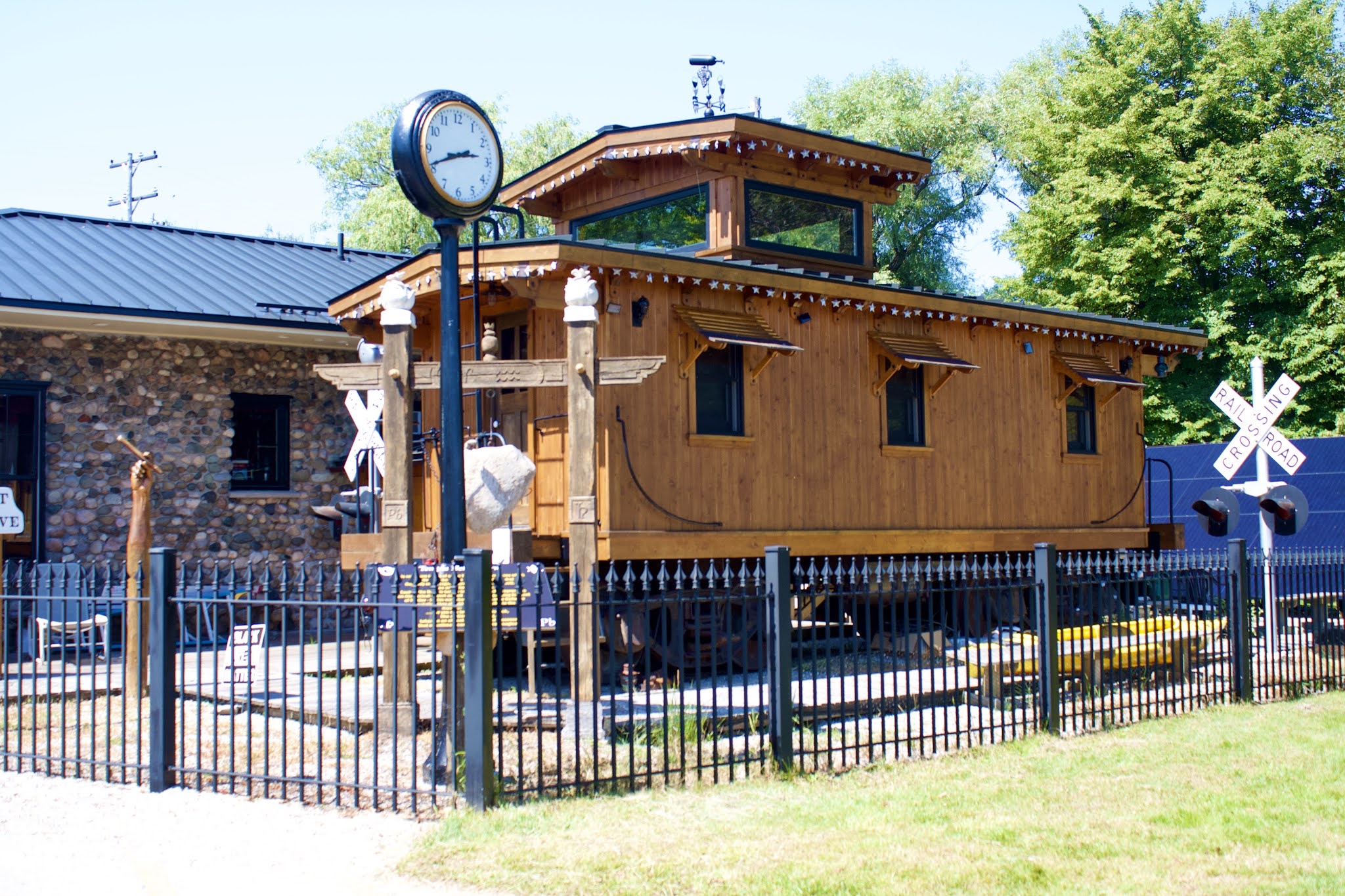
We entered the Upper Peninsula of Michigan on day 14 of our trip, staying at a Harvest Host before we set off for the Porcupine Mountains.
 |
| Big Snow Resort/Indianhead Mountain, Wakefield, MI |
 |
| Sunset first night on the Upper Peninsula |
We could see the Ottawa National Forest in the distance from the RV. Beautiful place to spend the late afternoon and evening. We had a leisurely afternoon and then the next morning before we sauntered over to the Porcupine Mountains Wilderness State Park around 13:00. There were two primitive camping sites open, we drove down to the sites and took site 38 looking over Lake Superior.
We booked a campsite for two nights and purchased a Non-resident Recreation Passport, good money spent with all the State Parks we would see along our journey.
We took the Stairway to Lake Superior that was a beach area filled with a family and their children. We spoke with a couple who had just eaten some of the red berries, we picked them but they weren’t raspberries. The women told us they were thimbleberries native to the area. They were delicious, we kept picking them and enjoying every bit.
We found a trail along the Presque Isle River over the River to the East Trail (which is part of the North Country National Scenic Trail, which runs from North Dakota to New York). The River flows over Nonesuch Shale into Lake Superior.
 |
| Presque Isle River Campground, Porcupine Mountains Wilderness State Park |
 |
| Presque Isle River |
 |
Us along the Presque Isle River at Nawadaha Falls
|
 |
| Shale eroded overtime by the river |
Over time the shale has eroded leaving step falls along the river. The largest fall is named after the Ojibwa Indian God, Manabezho. It was amazing to walk along this super powerful river. The hike at times was vigorous and challenging walking over tree roots, rugs and other obstacles while climbing up the side of the hill. We hiked 3.36 miles that took about 3 hours.
 |
| East Trail along the Presque Isle River, Manido Falls |
 |
| Stairway to Lake Superior |
 |
| East Trail along the river |
 |
| Taking a break along the river |
 |
| East Trail |
 |
| We found it, North Country National Scenic Trail |
 |
| Manabezho Falls from the East Trail |
 |
| Manabezho Falls from the West Trail |
 |
| Relaxing at the end of a busy day of hiking and exploring |
 |
| Another day draws to a spectacular end |
We decided to chance and see if we could more to Union Bay Campground on the other side of the park. We checked out of Presque Isle River Campground, the ranger called Union Bay for us. Union Bay has a site for us to take, we drove to The Visitors Center to confirm the site. The drive is 25 miles from the South Boundary.
We walked 5.25 miles this morning from Summit Peak Trail to Mirror Lake Trail and back on Little Carp River Trail to Beaver Creek Trail and Summit parking area.
 |
| Summit Peak, elevation 1950 |
 |
Mirror Lake
|
 |
| Little Carp Trail |
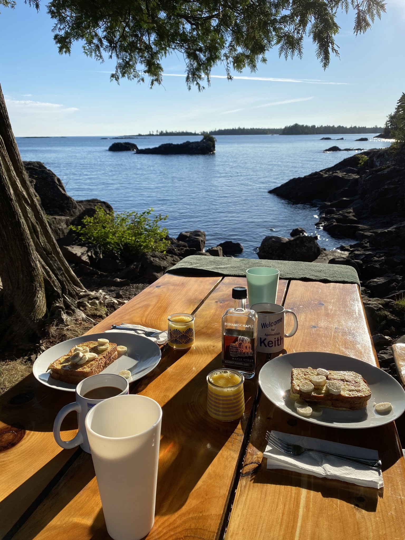
We have settled into site 16 in Union Bay Campground right on Lake Superior. We are parked in place, have electricity and a breathless view, our chairs out, lunch being made, thimbleberries to pick, yet it is only 15:17. It does not get any better.
 |
| Site 16 is right on the lake, walk down and go for a swim |
 |
| Million dollar view from the RV to Lake Superior |
 |
| Wildflowers along the shale coast |
 |
Keith taking advantage of our location as the sun sets
|
 |
| A great view for dining outdoors |
 |
| Our guest taking some crumbs |
Our last day in the Porkies (Porcupine Mountains Wilderness State Park) was spent hiking at Lake of the Clouds then hike Escarpment Trail across the lake from above towards Union Bay. Really nice hike along escarpment rocks, roots and some mud. Elevation changes and bright sun, some cool areas in the shade and lovely tasting thimbleberries.
We walked 5.14 miles. We were a little tired when we got back. We had dinner and crashed at the dinette.
 |
| Lake of the Clouds |
 |
| Escarpment Trail above the lake |
Along the trail we found and devoured thimbleberries to our delight. We walked up to the overlook to see the sun shadows. Really beautiful at dust. We stayed in Lake of the Clouds Overlook for the night. Both of us are sore and exhausted from today’s walk.
 |
| Sunsetting through the trees on the path |
 |
| Woke up at 5:45, got dressed put on my long arms and walked 300ft to the overlook to watch the sunrise. Nice way to start the day at Lake of the Clouds before we leave for Keeweenaw Penninsula. |
 |
| Coneflower |
On the road again and ready to continue exploring the Upper Peninsula. We start by heading towards the Keeweenaw Peninsula and break in Houghton for lunch before crossing over the Portage Lift Bridge. After lunch we carry on to Calumet (also known as The Red Jacket, its original named, after a Seneca Indian Chief).
 |
| The Portage Lift Bridge, is the only land-based link between the north (so-called Copper Island) and south sections of the Keweenaw peninsula. The center of the bridge can capable of being lifted from its low point of four feet clearance over the water to a clearance of 100 feet. |
 |
| Historic Downtown Calumet, Keeweenaw National Historic Park |
 |
| Calumet Municipal Theatre and Opera House was constructed in 1900. |
 |
| The theatre was added to the National Register of Historic Places on August 5, 1971, and is also a Michigan State Historic Site. The Theatre is one of the venues in the Keweenaw which hosts The Red Jacket Jamboree, an old-time radio variety show heard on local public radio Stations. |
The Calumet's claim to fame was the copper vein found around 1860's and the boom began producing from 1871-1890 producing more than half of US copper. The Theatre and Opera House is the longest running municipally owned theatre in the United States. We enjoyed the tour of the interior seeing why this was a grand old theatre back in the day.
 |
| Interior ceiling of the theatre |
 |
| Beautifully constructed and maintained structure |
After a long day of driving and touring around Calumet, Eagle Harbor and Sand Bay Harbor we stopped over night at Esrey Rodside Park (Mohawk, MI) in between Eagle Harbor and Copper Harbor off Route 26, ate dinner and decided to stay overnight on the shoreline. Beautiful view and the sunset will be amazing.
 |
| Road entering the State Forest Mandan Road to High Cliff Rocks |
 |
| Mandan Road |
 |
| High Cliff Rocks on Lake Superior |
 |
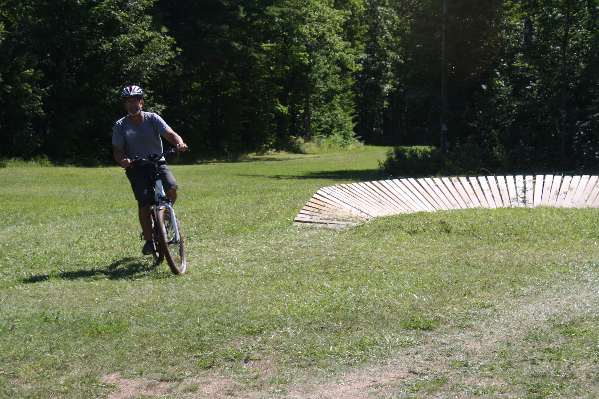
| Our ebikes are a game changer giving us more freedom and flexibility |
 |
| Wild flowers in the rock |
 |
| Blue bells on the rocks |
 |
| Thimbleberry, our new most sort after forage |
We boondocked for a couple of nights out on Mandan Road, complete peace and tranquility out in the forest with no light pollution. There are quite a few cars that do come down then turn around since the road gets really rutted.
 |
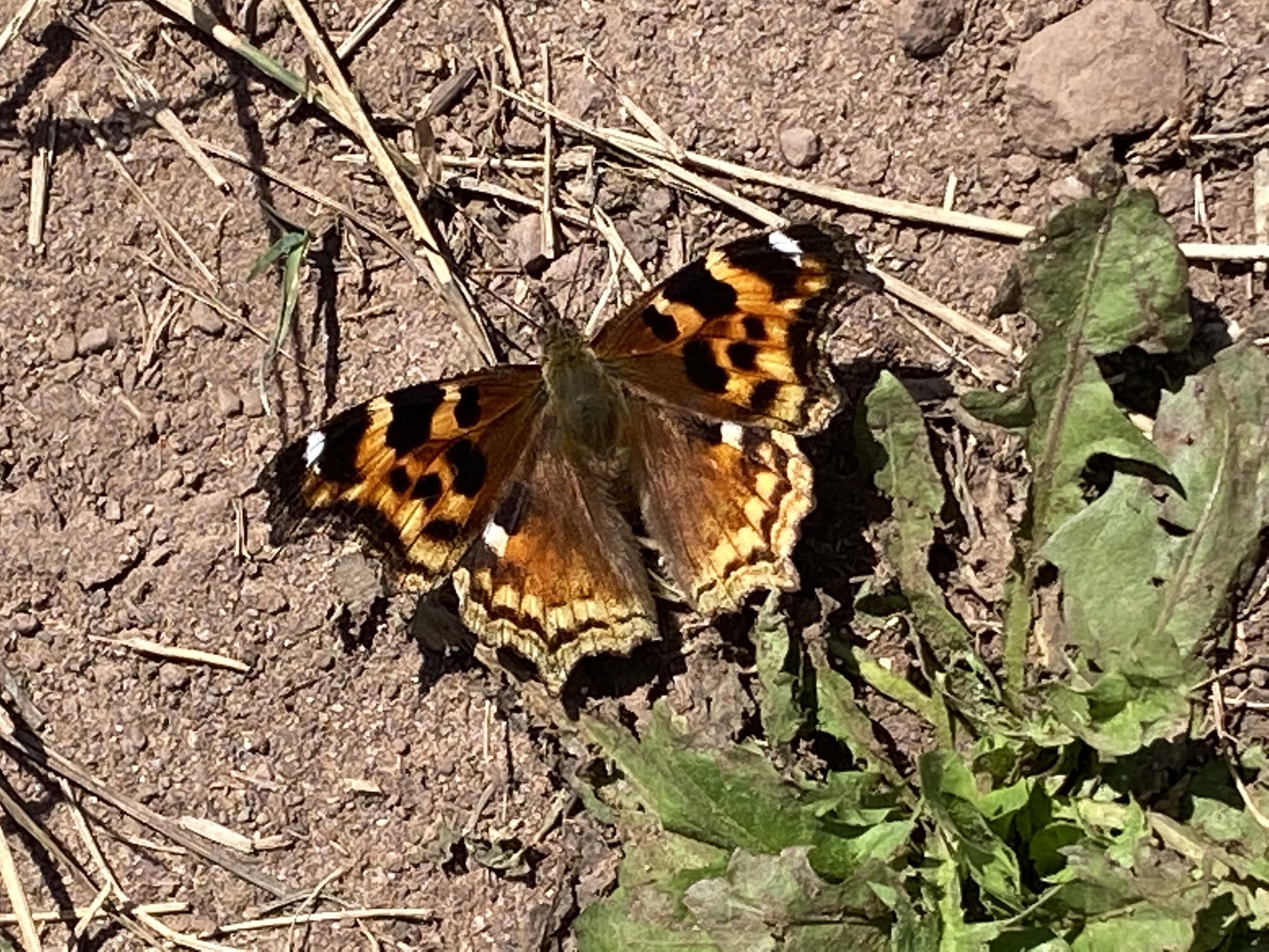
| Compton Tortoiseshell Butterfly |
 |
| Our home base for a couple of days, nothing but fields of wild flowers and forest |
 |
| A glimpse of the road after the rains as we prepared to leave the safety of the forest |
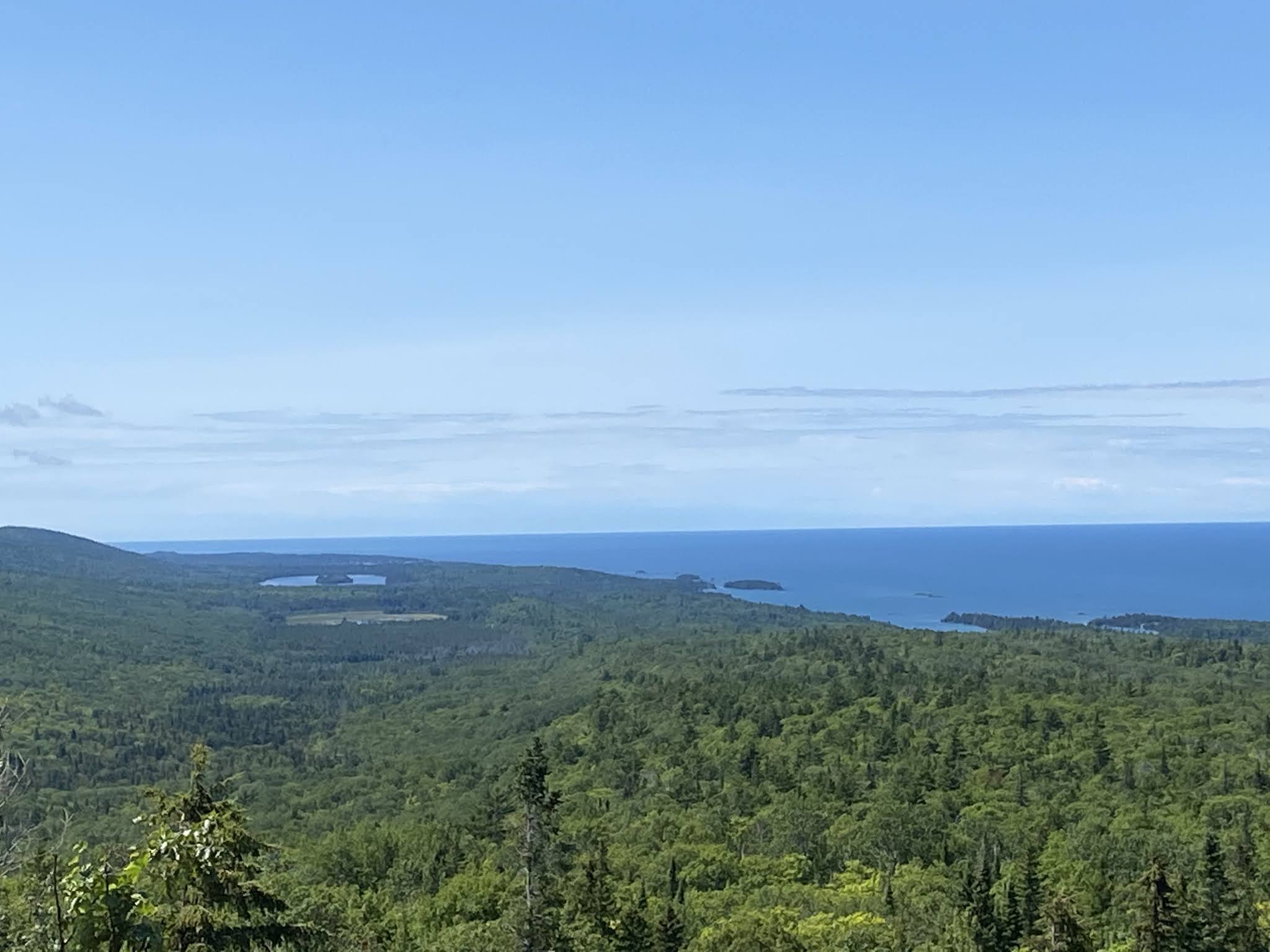
Time for us to head back through Copper Harbor and make our way down Keeweenaw Peninsula towards L'Anse. We stopped at Brockaway Mountain Overlook Roadway, remarkable vistas of the Lakes and Village (Copper Harbor, Lake Medora, Lake Superior) Skies were partly sunny, after a very cloudy and cool morning, it is 60° and glorious.
 |
| Fort Wilkins Historic State Park |
 |
| Copper Harbor Lighthouse |
Drove through Lac La Belle and stopped at Haven Falls on the way to Gay, MI. We stopped in Belle Grise off Oliver Bay on Gay Lac LaBelle Road at Brunette Park on Lake Superior, white sand beach with crashing waves.
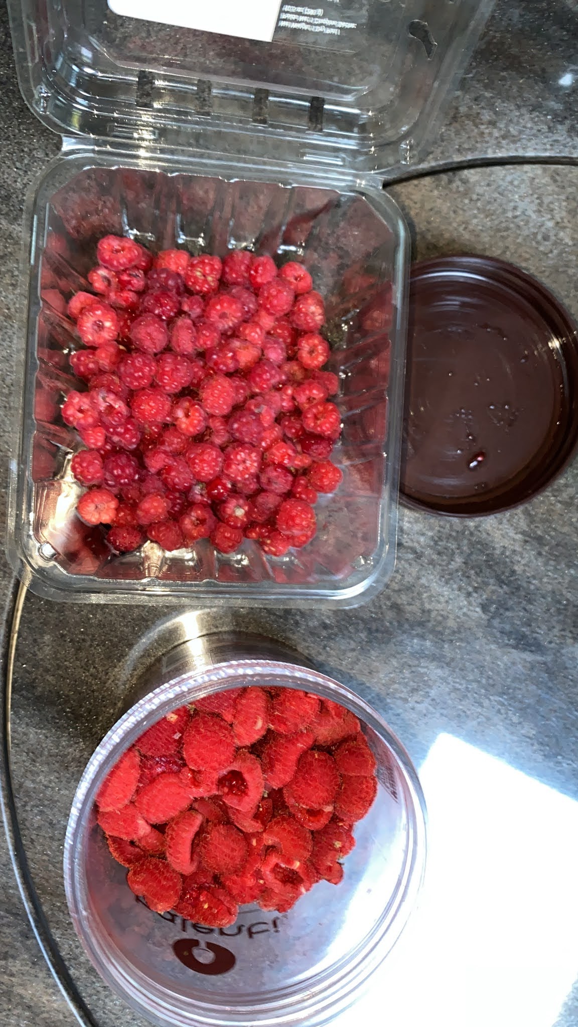
Our journey took us to Big Traverse on Traverse Bay, Lake Superior. Met Jeff Russell on the road, he was picking blueberries (low growth) off another dirt road, we found a place to boondock for another night. Foraging for a couple of hours for raspberries, thimbleberries and wild low growth blueberries (we picked quite a few containers of all three).
 |
| Brockaway Mountain Overlook Roadway |
 |
| Here we are on Brockaway Mountain Overlook Roadway |
 |
| West Bluff, Brockaway Mountain. Overlook Roadway |
 |
| Mohawk Stamp Mill 1900-1932, Gay, MI |
We walked around the ruins and saw other people doing the same. Very interesting area where the copper was release from the rock. The Mohawk mill crushed rock from the Mohawk mine to separate copper from waste rock. The stamp mills of the Keweenaw peninsula used enormous amounts of water to separate metal and ore from waste rock. The water from this process was pulled directly from Lake Superior and the finely crushed waste rock was then dumped back into the lake. This practice dramatically altered the lake shore over the years the mill operated. The shoreline from the mill South for a couple of miles is still a "stamp sand" beach a hundred or so yards wide. The population of Gay, MI reached several hundred during the heyday and no is close to 60 with the only business in town being the Gay Bar.
 |
| Gay Michigan is named after Joseph E. Gay, who explored the area finding the copper vein |
 |
| Boondocked off a dirt road near Big Traverse Lake |
 |
| Traverse Lake, Torch Lake Township |
 |
| Success we found low growth Wild Bluberries |
 |
| Thimbleberries and Raspberries |
 |
| Low growth wild blueberry |
We were hooked on foraging when we could, thimbleberries, raspberries and blueberries were plentiful and delicious. We could not get enough, we had them on French Toast, salads and by the handful. We spent hours just getting as many as we could. Wash and dry the blueberries and they will last a while but the softer berries had to be eaten faster, never a problem for us.
Before heading to Houghton, off the Keeweenaw Peninsula we stopped at the Hungarian Falls Nature Area in Calumet. This falls were highly recommended by several locals we had met.
 |
| Keith foraging for Thimbleberries |
 |
| Russell's Bolette |
 |
| Hungarian Falls, Calumet |
 |
| Keith sitting at the falls |
 |
| Wayne sitting middle section of the falls |
 |
| Black Trumpet fungi |
We hiked 2.74 miles up and down steep areas of roots and rocks. It was an invigorating hike for us. The more we can be in nature the better, plus we are socially distancing while we continue our tour of the UP.
We made it back to Houghton found a place for propane then headed off next street over to Närä Nature Park Trailhead really nice biking, hiking and cross country trails. More experienced mountain bike inner trails. We walked Närä Loop. Since the Boardwalk Loop across 41 was closed due to a storm in 2018 that destroyed a lot of the boardwalks and viewing platforms.
We walked back across 41 to get the bikes and rode Ridge Loop to Down Under to inner mountain bike loops out to where Royal Maple began. We took Down Under to Walk About to Ridge back to Närä to the rig (3.82 miles in 59:49). The weather has been pleasant even with all the exercise we have been getting, we are really taking in the Upper Peninsula and loving it.
 |
| Scrambled eggs, bacon, avocado and blueberries & thimbleberries with cottage cheese |
 |
| Thimbleberries in oatmeal with tamarind sugar |
We don't skip breakfast and have had some really nice meals while on the go, especially with the foraging.
 |
| Biking the Loops named after Lord of the Rings |
 |
| Keith leading on the Ring Loop |
 |
| Playing around on the obstacle course |
We entered the trails at Michigan Tech University Waxing Center at Tecumseh Trail to Core Loop, Troll Loop to Ring Loop to ENT Loop to to Ring then Gnome Loop then Ring to Elf Loop back to Ring them last one is Hobbit Loop, we then back to the Trailhead. 4.57 miles in a little over an hour. The trails were challenging because we had to pay attention to the roots, pointy rocks, narrow paths and narrow bridges in marshes and zigzag bridges. Overall, we had a good time, great experience and a ton of fun.
 |
| Portage Lake view at Michigan Tech University, Houghton |
With no schedule we stop as frequently as we see fit. We drove about 20 minutes and stopped in L'Anse. We walked around the L'Anse Lighthouse then went swimming. We were in the Ojibwa Recreation Area, part of the Keweenaw Bay Indian Community, the campground location is beautiful.
 |
| L'Anse Lighthouse |
 |
Keeweenaw Bay in L'Anse at the Ojibwa Recreation Area
|
 |
| L'Anse Village by the Bay |
We have been really active even with driving, stopping to hike, swim and bike along our journey. We made it to Marquette, MI. The Iron Ore Trail is here and runs to Harvey to the East and Republic in the West crossing the Marquette Iron Range for 47 miles. The location is beautiful right on Lake Superior.
 |
| Lower Harbor Ore Dock, built 1931 constructed to transfer iron ore into cargo ships |
 |
| The Iron Ore Heritage Trail |
 |
| Downtown Marquette |
 |
| View from the Iron Ore Heritage Trail |
 |
| Sunset over Lake Superior |
 |
Marquette Harbor Light
|
 |
| Parked at 7 5/8 mile mark on The Iron Ore Heritage Trail |
Rode to Presque Isle Park and met Robin & Pat, who were kayaking in West Greenland style kayaks. We chatted with them for about 1/2 hour before we headed back, passed the rig and to the Welcome Center Trailhead to Harvey. We made it to Choclay Bay and were slightly lost starting back at mile mark 4. The Iron Ore Heritage Trail was so much fun, great way to see the area, in total we did 25 miles of riding and touring.
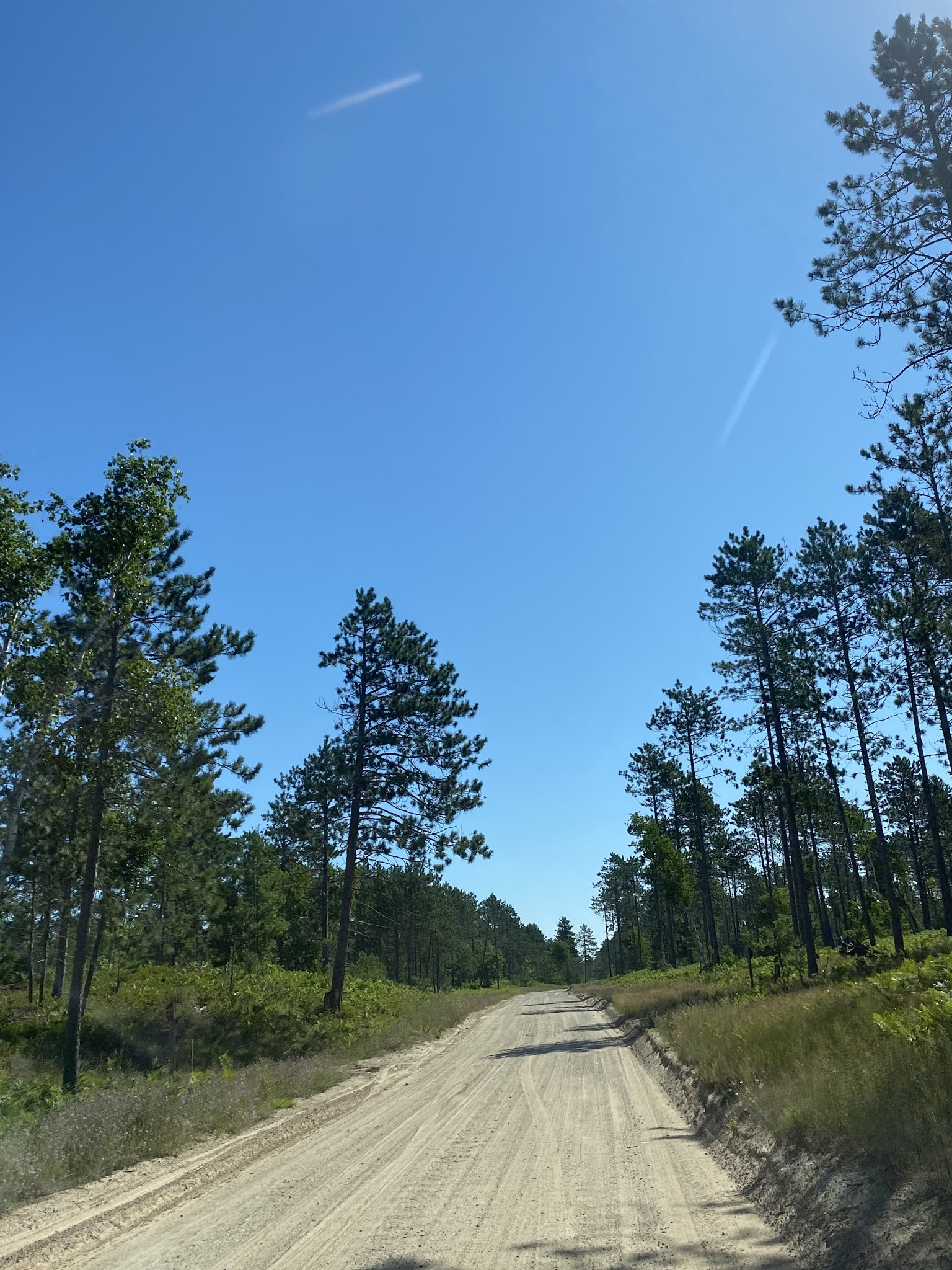
We left Marquette the found another off the beaten path, dirt road this time through Hiawatha National Forest, fun and hairy only because of low hanging tree branches at times.
We had to stop before getting to Munising in of all places Christmas, MI for gas.
 |
| Presque Isle - Summer, 1891. Fredrick Law Olmsted, a landscape architect most famous for his role in designing New York City’s Central Park visits Marquette to work on a design project. To make the most of his visit, the city also directs him to a large peninsula just north of town in hopes of designing a management plan to turn it into a suitable park. |
 |
Presque Isle Park, 323 acre forested peninsula along Lake Superior
 | | Choclay River along the Iron Ore trail |
|

|
| Iron Ore Heritage Trail towards Harvey |
 |
| Salad for lunch with thimbleberries |
 |
| Welcome to Christmas, MI |
We had dinner at Prime Taco in Munising, MI, we asked if we could park overnight in the parking lot since the municipal campground was booked through September. We boondocked at Prime Taco that evening.
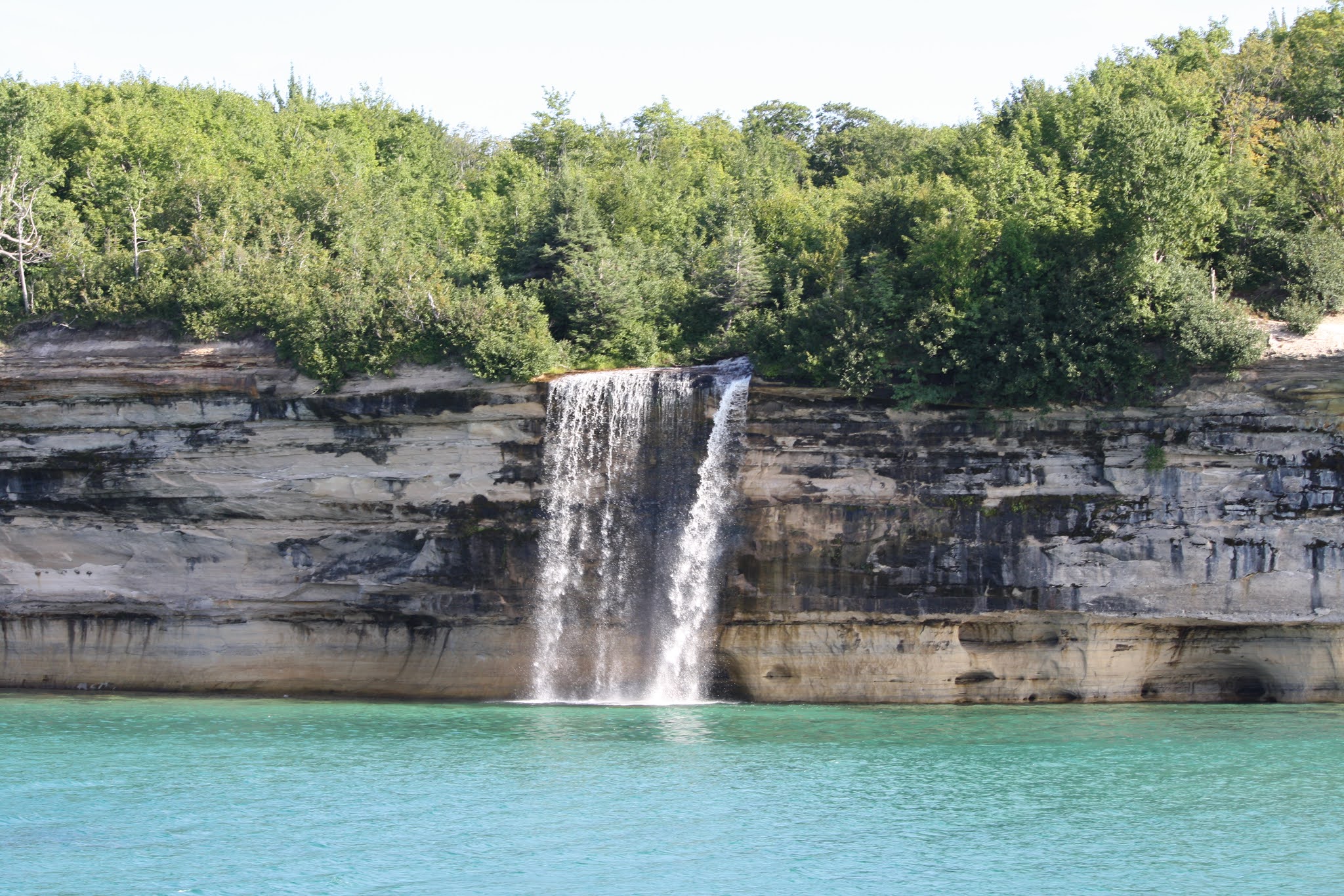
After a beautiful boat trip of Pictured Rocks National Lakeshore, cannot say enough about the boat tour, incredible views along the shoreline. We returned to a business card on our windshield from another LTV couple in a Serenity from TX (Karen Sharpe and Martin Caponi.
We met Karen and Martin for sunset over Lake Superior at Sand Point. The conversations flowed so easily, the time ticked away without our even guessing it was after 22:00. We moved to Family Fresh Market for our over night, rose the next morning for a 10 mile hike with them Mosquito Falls, Chapel Falls via Chapel Loop. The views were amazing, wet, muddy hike in the pouring rain. It rained hard on and off. We had all said towards the last 3 miles it would be nice to have cover. We walked around and a Church Youth Group has a huge tarp covering a very inviting fire. We were invited to come stand by the fire and offered coffee.
 |
| We are so excited, tickets in hand, 50% capacity and mandatory masks |
 |
| Sunset at Sand Point, Pictured Rocks National Lakeshore |
 |
| Chapel Rock |
 |
| Grand Portal |
 |
| Spray Fallls |
 |
| Spray Falls |
Miners Castle
 |
| Hiking Mosquito and Chapel Rock Loop in the foggy rain |
 |
| Chapel Rock up close |
 |
| We found North Country Trail again |
 |
| Wayne and Keith at Chapel Beach |
 |
| Lover's Leap |
 |
| Martin, Keith and Wayne above Lake Superior |
 |
| Upright Coral Fungus |
 |
Sided by sided LTV Serenity
|
After leaving Chapel Falls, we drove a bit then turned onto Little Beaver Lake Campground road, drove 3 miles to the campground. Dale and Kim approached us as we made the loop, they are on site 3 and offered site 4 that he reserved for a friend that won’t arrive until Tuesday. We backed into the site, thanked him and exchanged names. It is a small world, they are from Caledonia. They live 1 mile from Gram's house.
We spent 3 nights in Little Beaver Campground hiking, kayaking and swimming. We had a couple of meals we shared with Dale, Kim, their daughter Cali and her friend, Cody. We really enjoyed our time with them, felt really comfortable with them.
 |
| Little Beaver Campground, Site 4 home for 3 nights |
 |
| Our first night in Little Beaver |
 |
| Little Beaver Lake, we borrowed the kayaks |
 |
| Perfect morning for kayaking |
 |
| We kayaked over to Big Beaver Lake |
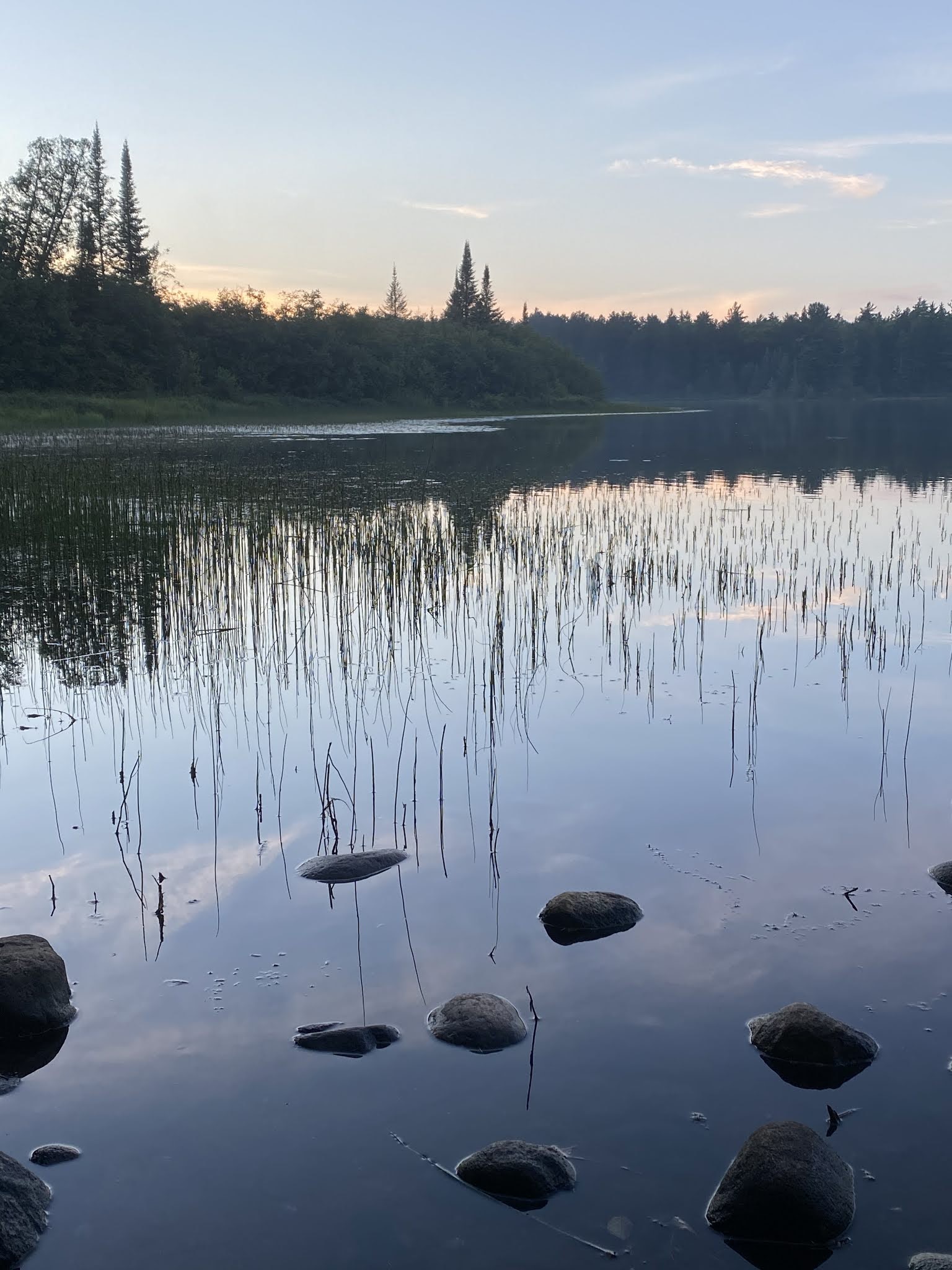
Our adventure here at Little Beaver was refreshing, we saw so much wildlife and made a new connection with Dale and Kim. We spent time in the mornings having coffee, evenings chatting and enjoying the campfires. We did some hiking on different trails coming out of Little Beaver into Beaver Basin Wilderness, that was following our 1.90 mile kayaking.
 |
| Beaver Basin Wilderness Trail |
 |
| Beach on Lake Superior |
 |
| Our last evening in Little Beaver Campground |
We are off again continuing the Lake Superior Loop heading towards Grand Marais. We got lucky and had a primitive site in the shade at Woodland Park, got out the bikes rode around this quaint little town. A real gem on the lake.
 |
| Grand Marais |
 |
| Woodland Park beach |
 |
| Sunset on Lake Superior, Woodland Park |
We hopped onto H58 to Grand Marais Truck Trail to Muskallonge State Park on Deer Park Road then into Two Heart. We drove 12-15 miles on dirt road along the lake.
 |
Deer Park Road eastbound
|
 |
Muskallonge Lake State Park
|
 |
| Muskallonge Lake State Park, best park of staying off interstates |
Stopped at the Upper Falls of Tahquemenon State Park walked .25 miles to the falls on the North Country National Scenic Trail. We saw the Lower Falls, 3 of the four falls were visible from the viewing area. The Upper Falls are really impressive. The falls parking lots are packed with people for a weekday.
 |
Tahquemenon Upper Falls |
After hiking the falls we set off for our next stop Au Sable Point, Shipwreck Beach then Whitefish Point home of the lighthouse, sinking of the Edmund Fitzgerald and Shipwreck Museum. Nice beach with tons of driftwood. We were delighted to be on the beach with ship wreckage scattered along it from old boats.
 |
| Au Sable Point |
 |
| Ship Wreck Beach |
 |
| Au Sable Point |
 |
| The Grand Sable Dunes |
 |
View of Lake Superior from Grand Sable
|
 |
| Whitefish Point Light |
After stopping at Soo Locks and boon docking overnight in St. Ignace we make our way off of the Upper Peninsula. We are looking forward to meeting Debbie and Pat at Barnes Park Campground in Eastport. We had a relaxing day sitting around, catching up since we last saw each other in February. We had a great dinner, walked the beach collecting Petoskey stones, watched the sun go down and sat by the fire pit.
 |
| Barnes Park with Debbie Long and Pat Allee |
 |
Search is on for Petoskey stones
|
 |
| Campfire, sunset and close friends |
 |
| Just the two of us and sunsetting at Barnes Park |
 |
| Central Lake, MI |
Just before we left Central Lake Village Market, with cherry brats in hand, we took selfie without our masks with Debbie and Pat. We so enjoyed the time spent with them.
 |
| Debbie Long, Pat Allee, Keith and me...Good Times |
After Central Lake we drove on Route 22 along the lake going through small villages like Suttons Bay. A little way down made our way to Northport, beautiful views of the water along Grand Traverse Bay. We made our journey to Grand Traverse Lighthouse on the top of Leelanau Peninsula, built in 1858.
 |
| Central Lake |
 |
| Suttons Bay |
 |
| Northport |
 |
| The Depot, est. 1920 |
 |
| Northport |
 |
| Grand Traverse Light on Leelanau Peninsula |
We were told a must see is Leland to tour the old town and fishtown area. (Leland, MI 19th century old fishing village Leelanau Peninsula) We grabbed ice cream and started to walk but it was melting too fast to walk. We walked around Fishtown. Saw amphibious cars and a 1947 Studebaker Pick-up truck.
 |
| 1947 Studebacker Pick-up |
 |
| Historic Fishtown, Leland |
 |
| Historic Fishtown, Leland provided fisherman access to the lake via the Carp River using small sailboats, before the use of gas powered boats in the 1900's |
We saw another brown sign depicting Pyramid Point, which sits approximately .6 miles from a trailhead along Basch Road in Glen Arbor. Then we took the Meadow trail walked 1.55 miles uphill then downhill, hot day of 86°. Was really humid hot walk.
 |
| Sleeping Bear Dunes National Lakeshore in Maple City |
 |
| We make our way up and up... |
We just love stopping and exploring different places. There was a turnout along the road, we stopped then Arcadia Lake. We made our way into historical Glen Haven then continued on through Empire, Crystal Lake and stopped overnight in Frankfurt. The morning we set our sights going South along Lake Michigan Loop.
 |
| Arcadia Scenic Turnout observation |
 |
| Arcadia Lake |
 |
| Arcadia Lake |
 |
| Arcadia Lake |
We left Alto 33 days ago, we are amazed how beautiful Wisconsin and the Upper Peninsula are during our touring. Before we headed to Alto, we stop at Manistee, walk the riverfront and historic area. The town is filled with old Victorian homes, the riverwalk was 1.5 miles long.
 |
| Manistee Riverfront walk |
 |
| Historic Manistee |
 |
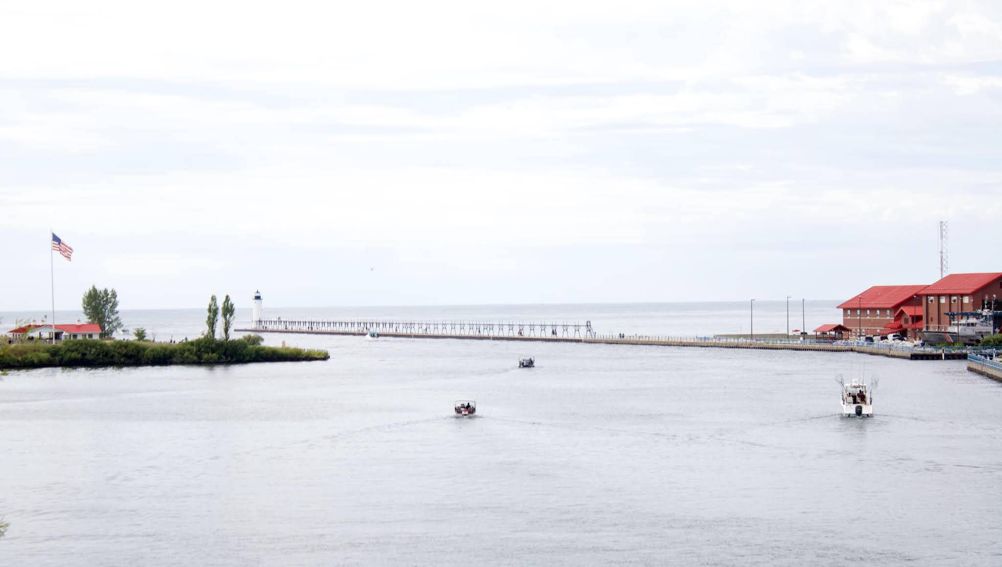
| Manistee North Pierhead Lighthouse |
We drove 182 miles today and surprised Gram with our arrival. Nice to be back in Alto after our fantastic tour of WI and MI. We saw friends we make keeping the connection going and made new friends along the way. We are very lucky to have this lifestyle.
 |
| 33 Days from Alto, MI through Wisconsin, Upper Peninsula of Michigan and back |